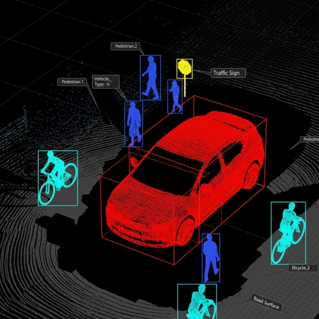
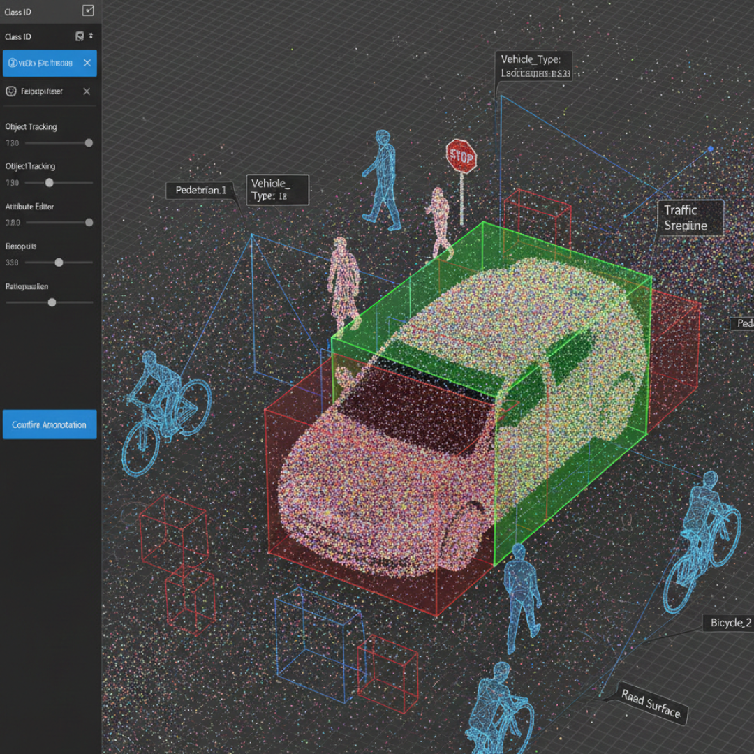
LiDAR annotation is the process of labeling and tagging LiDAR (Light Detection and Ranging) data so that AI and machine-learning models can understand spatial environments accurately. LiDAR uses laser pulses to measure distances and create precise 2D and 3D point-cloud data, which is essential for applications such as autonomous vehicles, robotics, smart cities, and mapping.
2D and 3D LiDAR annotation helps machines recognize objects, estimate distances, and understand real-world depth and geometry.
Benefits Our Services
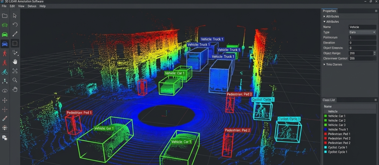
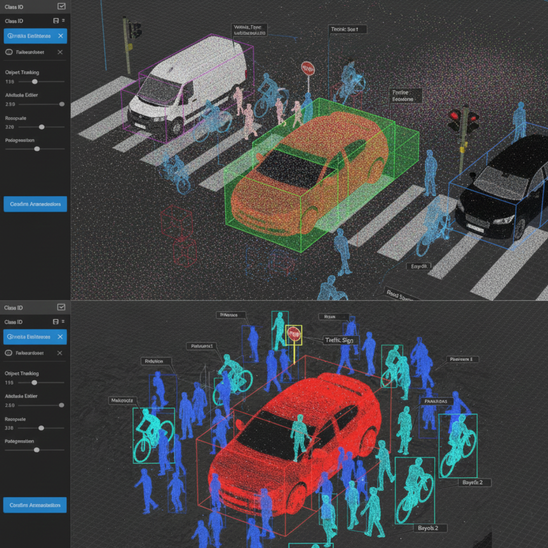
We provide accurate, human-led LiDAR annotation services including 3D cuboids, segmentation, and point cloud labeling. With scalable workflows, strict quality checks, secure data handling, and fast delivery, we support high-performance AI models for autonomous and 3D perception systems.
LiDAR annotation is the process of labeling 3D point cloud data captured by LiDAR sensors to help AI models understand depth, distance, and spatial relationships in real-world environments.
What types of LiDAR annotation services do you offer?
We provide comprehensive LiDAR annotation services, including:
3D Cuboid Annotation
2D Annotation
Point Cloud Segmentation
Semantic & Instance Segmentation
Object Classification & Tracking
Sensor Fusion Annotation (LiDAR + camera data)
Lane & Road Boundary Annotation
Which industries use LiDAR annotation services?
LiDAR annotation is widely used across industries such as:
Autonomous vehicles & ADAS
Robotics & automation
Smart cities & infrastructure planning
Construction & real estate
Mapping & geospatial analysis
Agriculture & forestry
Defense & surveillance
How do you ensure accuracy in LiDAR annotation?
We follow strict quality control processes, including:
Trained 3D annotation specialists
Multi-level QA reviews
Precise annotation guidelines
Cross-validation with sensor data
Advanced tools for accurate point cloud labeling
What tools do you use for LiDAR annotation?
We use a combination of:
In-house LiDAR annotation platforms
Industry-standard tools such as CVAT, Supervisely, and custom 3D labeling tools